NCSU College of Veterinary Medicine- Rhea Lab
Research Associate
Outside of this course, I have integrated these GIS skills to prepare spatial analyses and maps for research projects conducted with Rhea lab at the NCSU College of Veterinary Medicine.
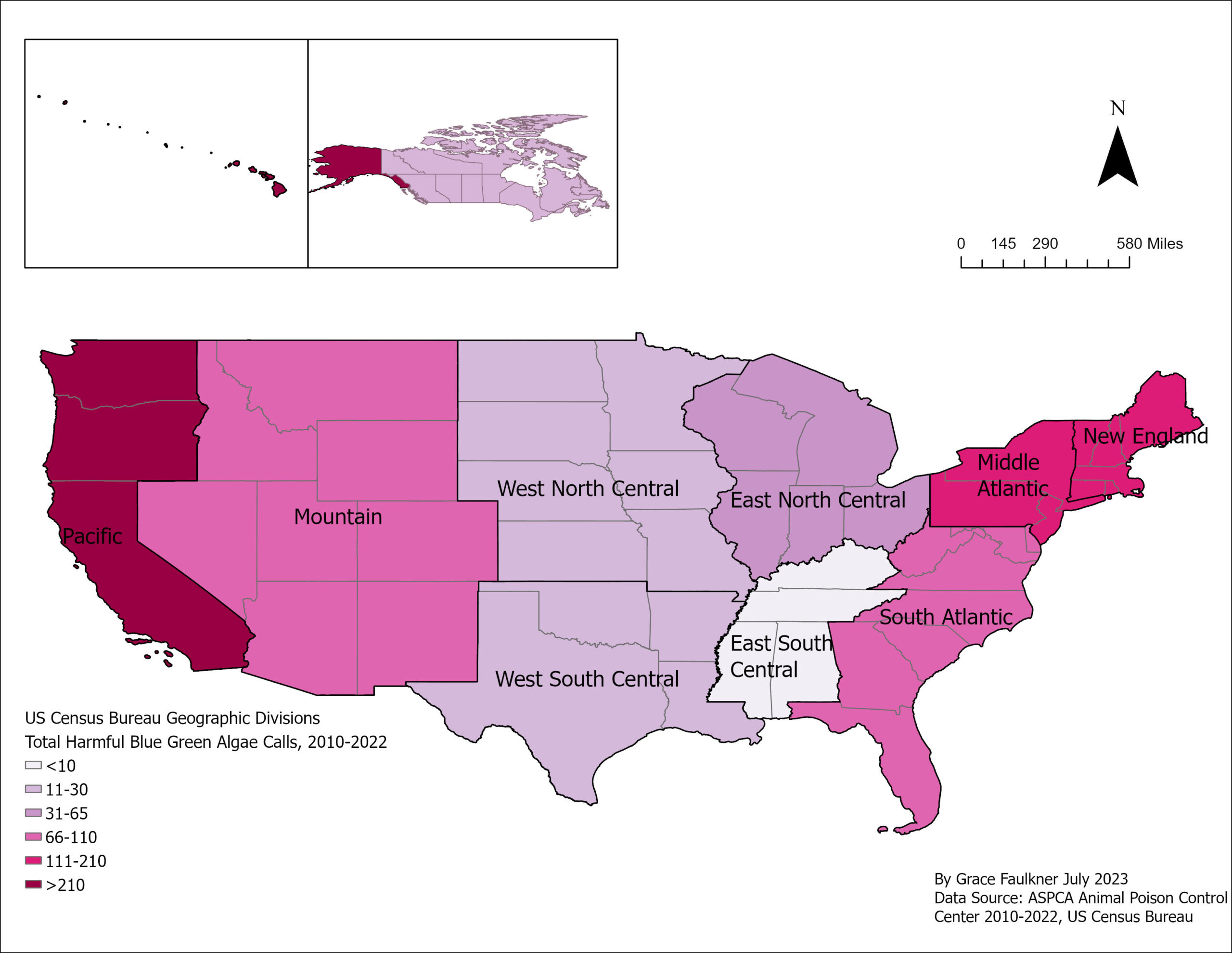
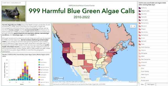
- Increasing blue-green algae exposure calls to animal poison control – North America, 2010-2022. Novel environmental sentinels?
- With Rhea lab, I co-authored a manuscript on harmful blue green algae exposures in companion animals from 2010 to 2022 in the US and Canada, which suggested the utility of these exposures as a public health information source for harmful algal blooms. The data from ASPCA Animal Poison Control Center included caller location, which I used to prepare a thematic map. These data was also used to create an interactive dashboard and Storymap. The Dashboard was featured at ESRI 2023 User Conference.
- With Rhea lab, I co-authored a manuscript on harmful blue green algae exposures in companion animals from 2010 to 2022 in the US and Canada, which suggested the utility of these exposures as a public health information source for harmful algal blooms. The data from ASPCA Animal Poison Control Center included caller location, which I used to prepare a thematic map. These data was also used to create an interactive dashboard and Storymap. The Dashboard was featured at ESRI 2023 User Conference.
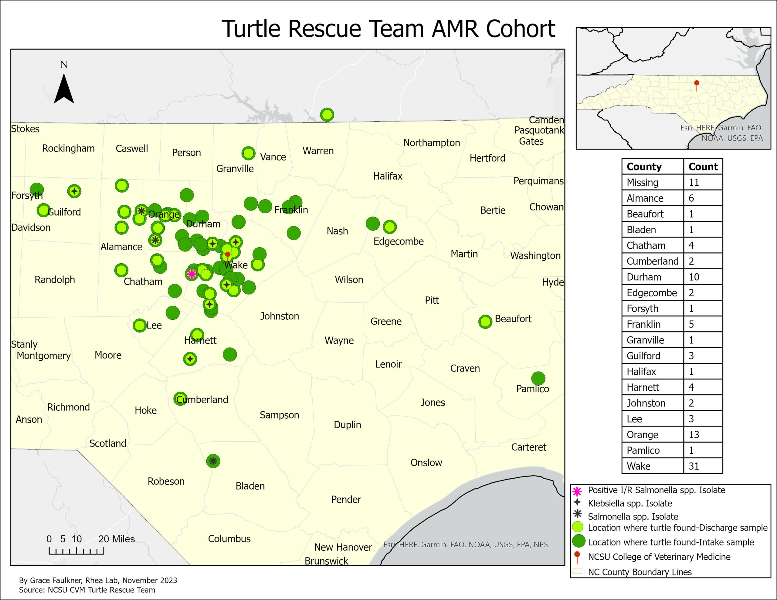
- Antibiotic Resistance in Local Turtle Populations: Pilot Project
- The Rhea Lab has been involved in a collaboration with the NCSU College of Vet Med Turtle Rescue Team in a pilot project to 1). Identify the presence of and characterize antimicrobial resistant bacteria among hospitalized turtles 2). Assess the feasibility of using admitted TRT native NC turtle patients as bioindicators of local antimicrobial resistance in the environment. This is an ongoing project with preliminary data.
- For this project, I created a dashboard and map of admitted turtle cohort members.
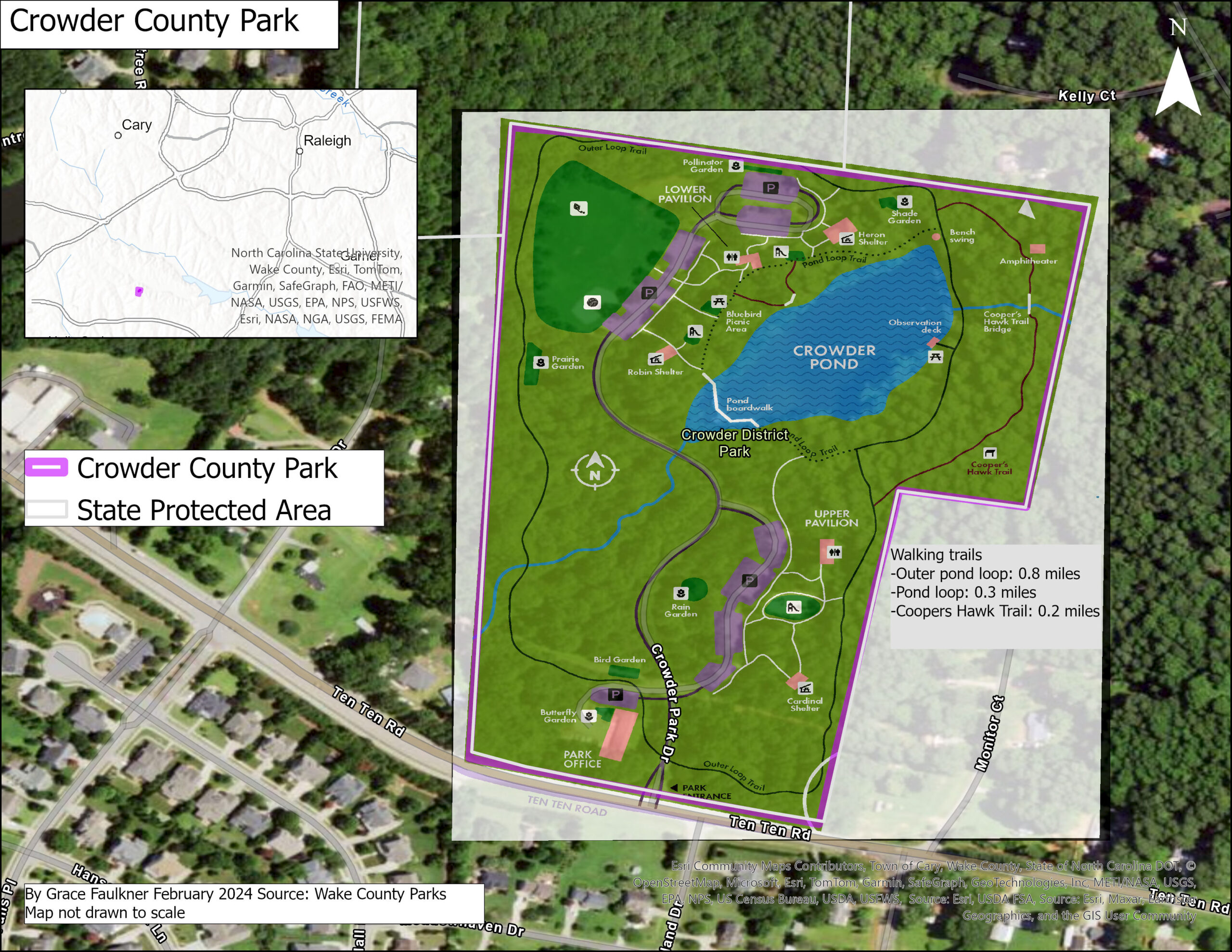
- This pilot project is also being used to inform a larger study with similar goals using wild-caught turtles. To inform collection planning and processing, I have georeferenced local wake county park maps.
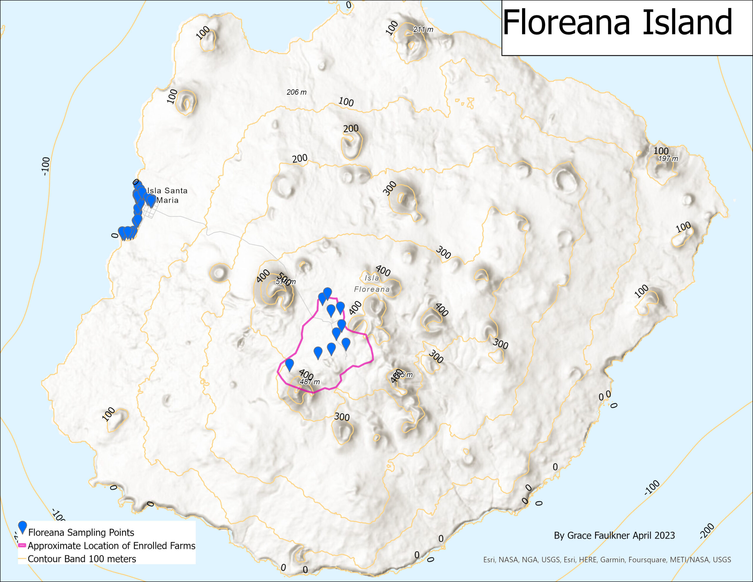
- Assessing Livestock Production Practices on Small-Scale Multi-Species Farms Located on Floreana Island, Galapagos Islands
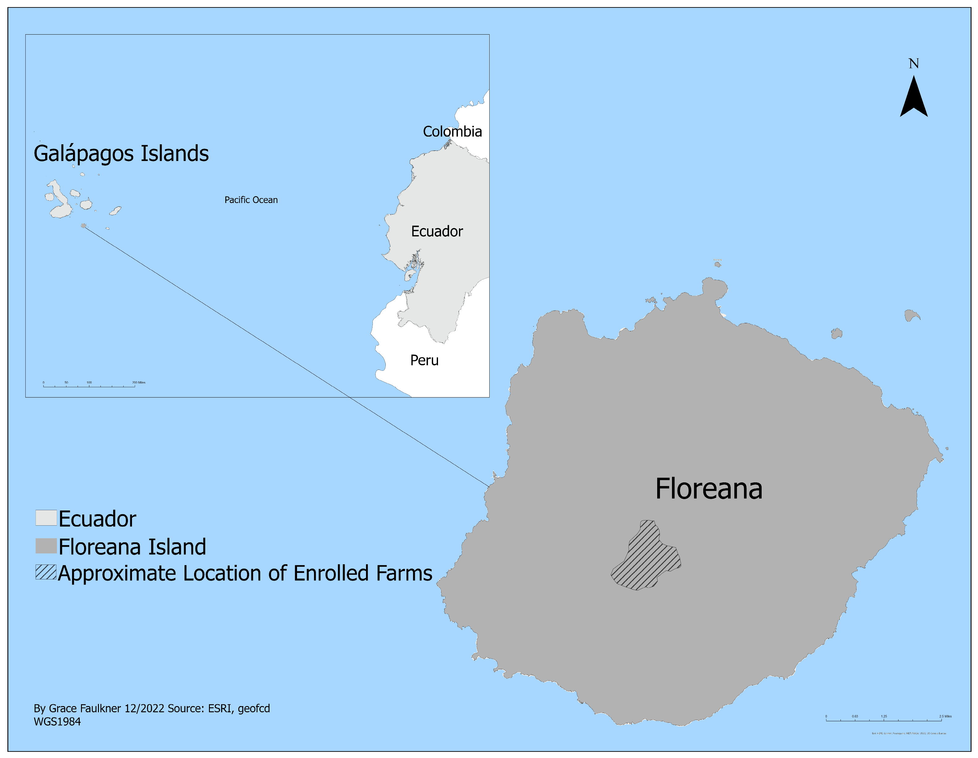
- I have been involved in Dr. Rhea’s research project on the Galápagos Islands exploring livestock production activities and antimicrobial resistance. I developed the data collection instrument using Epi Info, leveraged geographic data to create a map of the research activities that was included in publication, and maintained permits and applications between research the Galápagos Science Center and Galápagos National Park.
- I also prepared a terrain analysis of the sample locations. Using downloaded elevation raster data from the US Geologic Survey, I created contour bands of 100 meters.